“bright day – the sky was clear, the smoke and noxious, gaseous fumes that had hovered…since…Friday morning had vanished…” “…a more powerful gloom could be seen to cast its shadows across the doorways of most every residence and miner’s cottage of the thrifty village…” (FWV 12.9.07 pg.8)
~9:00 am
Inside the mines:
Large roof falls are found in every section but one in both mines. “The rescuers say they find great fall of earth from the roof and it is believed that tons and tons of earth, slate, coal and debris will have to be dug out of the main heading before arrangements can be made to operate this mine again.” (CDT 12.8.07 pg. 1)
“All of the young foremen in charge of the shifts and practically all of the volunteers were West Virginia mountain-folk. The mine manager had apparently excluded the aliens. ‘What is the matter with the foreign miners?’ I asked an intelligent young fellow resting in a coal car. ‘They can’t stand it,’ he said. ‘They can handle a pick all right, but when something happens, they lose their heads.’” (Forbes)
The “day of funerals” begins in Monongah and Fairmont
“At least a score of burials took place.” (Wash. Times 12.9.07 pg. 5)
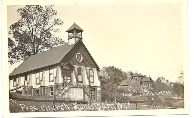
St. Peter’s Catholic Church in Fairmont conducted masses and some Protestant churches in Fairmont and Monongah held services.
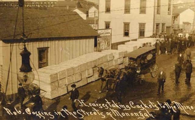
Undertaker’s wagon hauling victims in front of St. Stanislaus Polish Catholic Church
“Many of the victims of the holocaust are members of the Roman Catholic church and a majority of the burials of these will take place in a little church yard on a hillside near the parish house about a half a mile away from the mines in which they met death. Complete arrangements for the funerals have not been made but it is probable that the priests will celebrate the mass for the dead over many of them at one time.” (CDT 12.8.07 pg. 1)
“Funeral processions were in sight in all directions during the entire day.” (News)
“On the way to the cemeteries these solemn little processions were constantly going and passing vehicles coming from the mines laden with victims en route to the morgue, there to be placed in caskets and prepared another series of funerals.” (News)
“About twenty victims were buried today in the three cemeteries near the town. The services were simple and brief and except for the grief of the mourners, which at times became almost frantic, were without special feature.” (News)
“Several of the services were interrupted by women fainting, causing momentary excitement, but this was soon dispelled.” (LAH 12.9.07 pg. 2)
“All the churches offered up petitions for the peaceful repose of the dead, and ministers spoke feelingly of the disaster. But the saddest of the prayers were those of the women, who again gathered near the entrances, and chanted their litanies.” (CET 12.9.07 pg. 1)
In other parts of Monongah:
“Miners and other citizens from all over Central West Virginia are pouring into the Monongah to offer their services in the work of rescue.” (WH 12.8.07 pg. 13)
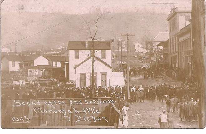
“The crowd of people that were at Monongah today was the largest that has ever been in the town on any occasion. Hundreds were there from all nearby towns and many from far away. A great number went only for the sole purpose of getting to look at where the mine disaster occurred. In this they were disappointed as nothing but two holes in the ground greet the visitor. It is impossible to go down in the mines and also to get in at the morgue.” (CDT 12.8.07 pg. 1)
“The people of the town are stunned by the catastrophe. They had long regarded these mines as practically immune from the dangers so common to the coal mining industry.” (LAH 12.8.07 pg. 1)
“The stage has been reached where relief for surviving dependents of the victims is necessary, and such progress was made in that direction today. Several organizations have been incorporated and the work is being systemized. Churches are taking the lead in this work. The coal company is showing a liberal spirit and is using money freely to relieve distress.” (LAH 12.9.07 pg. 2)
“Great quantities of food were distributed today.” (LAH 12.9.07 pg. 2)
“An American woman who lost her husband refused to believe he is dead. She has put clean linen on his bed and insists that he will be brought to her. ‘I know he is injured, and nobody can take care of him like I can,’ she said. She prepares his meal regularly, neighbors say, as she has done for years, thinking he may come for them.” (News)
~10:00 am
Inside #8:
“It is hardly possible that all the bodies will be recovered for several days. The men were working in a territory one mile square. It will be days before a thorough search of all of this area can be made. As the searching parties advance, they must clear away the debris.” (LAH 12.8.07 pg. 1)
Rescuers find a headless body sat in the seat of a cutting machine, hands still gripping the handles of the machine. (McAteer)
By 10 am, 1st right had been explored and 1,000 feet of 1st left when all efforts are called to the surface (McAteer).
Smoke is discovered coming out of crop openings south of the pit mouth so threatening it was decided to halt all work on north side until the south fire could be located and extinguished.
“There was a slight fire inside of the slope of No. 8 mine this morning, due to the starting of the fan. It was extinguished after an hour, and the fan, working successfully, greatly facilitated the efforts of the rescuers to get into the mines.” (News)
On the way to Fairmont:
A “prominent minister” tells a representative of the West Virginian while on one of the crowded cars returning from Monongah, “You newspaper men would have a hard time to exaggerate the awfulness of this great catastrophe.”
“And the minister’s remark suggests the thought that newspapers all over the country have been very conservative in their stories, especially as to the number of dead. Most of the papers have underestimated the number rather than overestimated it. Very few sensational stories have gone out when we consider how great the temptation is under the circumstances.” (FWV 12.9.07 – pg.8)
~10:45 am
“Monongah restaurants have been almost ‘eaten out’. In spite of the fact that food supplies are being rushed to the mining town as fast as possible, there is not enough food at public restaurants, hotels and like places to accommodate the people. In the restaurants and hotel where some food can be obtained, the patrons have to take just what is on hand. Coffee is being drunk without milk and sugar and in many instances all that a hungry person can find to satisfy himself with is plain bread. Some of the residents have kindly thrown open their door to the hungry and are giving them what they have on hand to eat.” (CDT 12.8.07 pg. 1)
A majority of church services begin in and around the area of Monongah
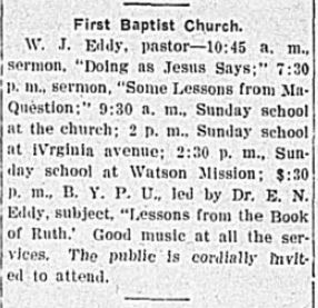
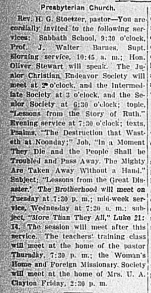
Several church services and Sunday school lessons focus on the Book of Ruth (aka: The Widow’s Book or ‘The Tale of Two Widows’) today.
“The Presbyterian Church has asked the Presbyterian churches of Pittsburg and vicinity to come to the rescue of the widows and orphans.” (FWV 12.9.07 – pg. 1 – extra)
FWV 12.7.07 pg 8FWV 12.7.07 pg 8
~11:00 am
“E.C. Vandiver, of Lonaconing, was in Monongah over Sunday and tells a gruesome tale of what he saw and heard there. Van left here Saturday and returned Sunday night.” (CET 12.10.07 pg. 6)
“Van saw piles of coffins on every corner and the wailing of women and children was heartrending.” (CET 12.10.07 pg. 6)
“Thousands of strangers were in Monongah and the hotels are crowded.” (CET 12.10.07 pg. 6)
“Seven families that Van saw had lost every adult male and fifty children in those families are left fatherless. Van saw men working at No. 6 mine but saw nothing doing at No 8 and was told that no one would venture in.” (CET 12.10.07 pg. 6)
“He saw one woman identify the body of her husband by the nail on the only finger left on his hand. This finger had been injured years ago and the end was gone. This man was an American.” (CET 12.10.07 pg. 6)
“The bodies were laid out in the bank building used as a morgue and thousands of people gazed upon them. At Fairmont, Sunday, people fought each other to get on the street cars for Monongah. Van returned full of the horror of what he saw.” (CET 12.10.07 pg. 6)
“The women around the mine entrance are going crazy with grief and can hardly be handled.” (FWDN 12.6.07 pg. 1)
Crowds are growing to uncontrollable numbers. (News)
Agents for the company begin to prepare for the worst.
~1:00 pm
On the east side of Monongah:
“At one o’clock this afternoon the officials of the Fairmont Coal Co. revised their figures as to the number of men at work in the mines, making it three hundred, instead of five, and they do not believe any have escaped death or injury of a serious nature.” (CET 12.6.07 pg. 1)
Coroner E.S. Amos prepares to set up a temporary morgue inside the unfinished First National Bank of Monongah (a new institution owned by the Watsons and others).
“The First National bank building…has been rigged up for a morgue and the dead will be taken there as soon as recovered.” (FWDN 12.6.07 pg. 1)
E.P. Knight brings the piece of broken coupling pin to Frank Morris in the office of the company store for safe keeping then returns to the relief work. (Inquiry)
~1:30 pm
Outside #6:
Dr. Cook sees first 3 bodies brought out of #6; the 3 men who were found in the shed at the foot of #6 slope. (Inquiry)
~2:00 pm
Outside #6:
8 bodies found near entrance of #6 “and had been taken out, but at that time dense volumes of smoke from a fire in the heart of the mine drove the rescuers to the open air and they have not since been able to return, although every effort is being made to get in.” (Pitt. Press Evening, 12.6.07 – pg.1)
“The fans were all blown out of mine No. 8 and it was the belief of some that the mine was afire.” (CDT 12.7.07 pg. 1)
At the mines:
“Little was done…until after three o’clock when several men were rescued.” (FWV 12.7.07 pg. 1 – noon)
There are several reasons why Appalachians have their own special language about their land. The most prominent reason is that ‘proper’ English simply isn’t good enough to help with navigation. Those basic terms work just fine in the foothills and the flatlands, but deep in these ranges and forests we need to get a little more specific so we don’t end up on the wrong side of the mountain. So, we tend to make up our own words or adapt existing words to take on a new or more specific meaning which is why terminology will differ depending on where you go in Appalachia.
Terminology matters just as much today as it did in the times before GPS and vehicles. Mostly because this terminology is included in the names of many places, like Mill Fall Run, and if you lose your satellite reception (which will happen in certain parts) knowing your terminology can help you “get to where you need to get” all on your own just like the early settlers or those on the Underground Railroad.
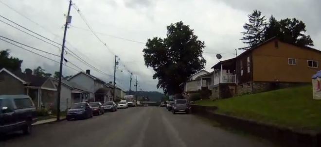
The layout of Monongah and its surrounding area is a perfect example of the terminology and its relevance. I am a ‘visual’ person so I will use lots of pictures to get you familiar with our terminology as it applies to this little town, its people and the surrounding areas.
GEOGRAPHY
Land
Well, just in case you didn’t already know, we are located in the Appalachian Mountain range which extends from the deep south all the way up into Canada on the east coast. West Virginia is the only state completely engulfed by this range. Even when we were part of Virginia, they still referred to us as “Western Virginia” and, basically treated us with the same indigence. We were those rugged, backwoods “Mountaineers” who lived off the land with only the very basics and enough to ‘care for our own’. The proper English folk of the Colonies had no use for us if they couldn’t profit from us so, the area was mostly neglected and remained severely isolated from ‘society’ until coal was discovered. By that time, we had developed our own complex language and various dialects to accommodate our environment. Despite the best efforts of the “Americanization” process of the early 20th century, that language still thrives today and it helps to know the very basics.
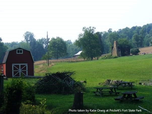
This photo is of the Morgan Cabin at Prickett’s Fort State Park only a few days after an arson incident when the old pioneer house was set on fire.
The Valley
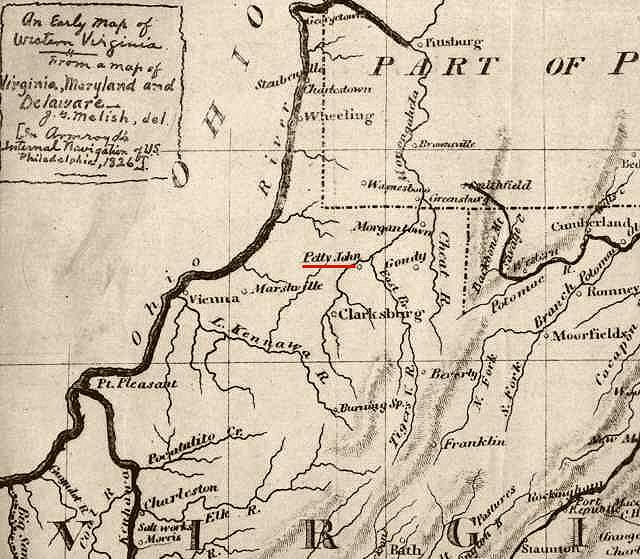
Valleys are elongated lowlands between other uplands along major waterways and typically play permanent host to major cities or towns. Therefore, they are more populated and hold most of the resources for the area. Monongah sits in a valley along the West Fork River. At the time all of the ‘official’ mapping and naming was going on, we were included as part of the Monongahela/Tygart Valley Region. This probably explains why most of Monongah’s earliest settlers got their land by tomahawk rights.
If you love history and old photos, I highly suggest browsing the extensive online collection of the West Virginia & Regional History Center at WV Dept. of Arts, Culture, and History
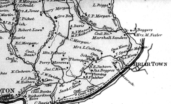
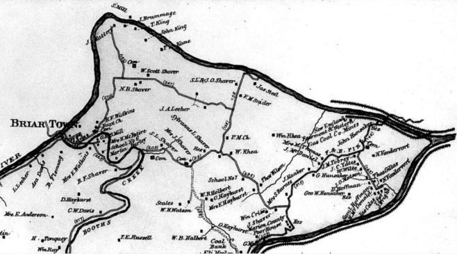
When it comes to the time of tales like ‘Coffin Hollow’, this place was still just a collection of isolated farmers in a small hollow known as Briar Town. Once transport to and from the hollow was established via railroad, bringing industry and a population boom to the area, her status was upgraded to valley and the hollow known as Briar Town became the town of Monongah – a suburb of the city of Fairmont.
These are screenshots of a map of the area from 1886. The East side of Briar Town is in the Grant District. The West side of Briar Town is in the Lincoln District. Link to the website where these maps can be viewed or purchased are in description
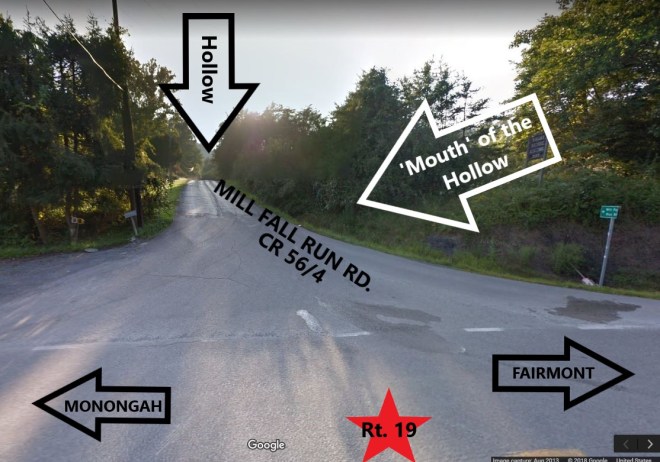
The Hollow
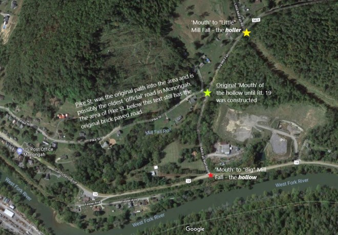
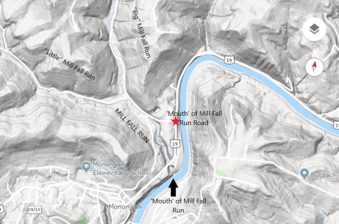
Hollowsarevalleys – an area of land that has been drained or irrigated over time by a water system which may or may not still exist; the second definition of the word valley. The key difference is that a hollow is located on higher ground within the landscape surrounding what is considered to be THEvalley. Though the ‘mouth’ of the hollow may be located in thevalley, it’s typically not the only way in or out. It’s simply the most direct way into the hollow from the main road or path which almost always follows along the main valley and its waterway, hence the term ‘mouth’.
It’s all about navigation.
The most important thing to know about what constitutes a hollow these days, is its road system. In a city, rather than walking all around the block to get to the next street, you may try to cut through an alley or ‘backstreet’ because the shortest distance between two points is a straight line, right? But, you will use caution because alleys are notorious for their potential dangers and a wrong turn can send you in the worst direction. Hollows are just like alleys.
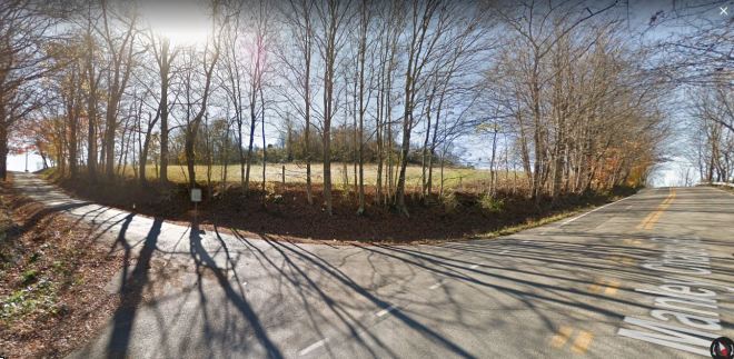
Hollows can usually be determined by the width and conditions of their roads. An existing and mapped road wide enough for two cars to pass side by side, though it may be a tight squeeze, is your typical hollow road. The ‘mouth’ of the hollow is often paved but it doesn’t always stay that way throughout. Main routes which pass through hollows are paved, painted, and mapped by Google Earth like any typical road these days.
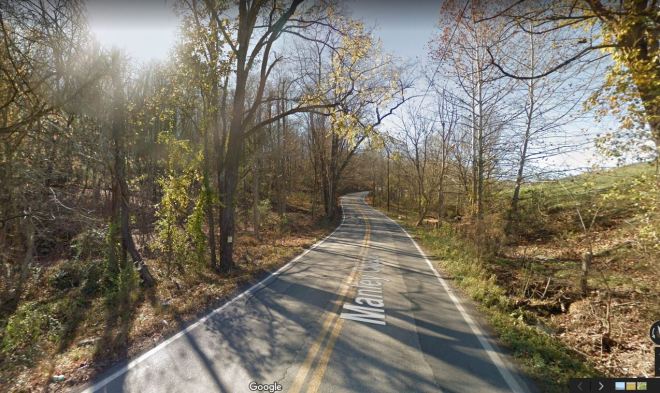
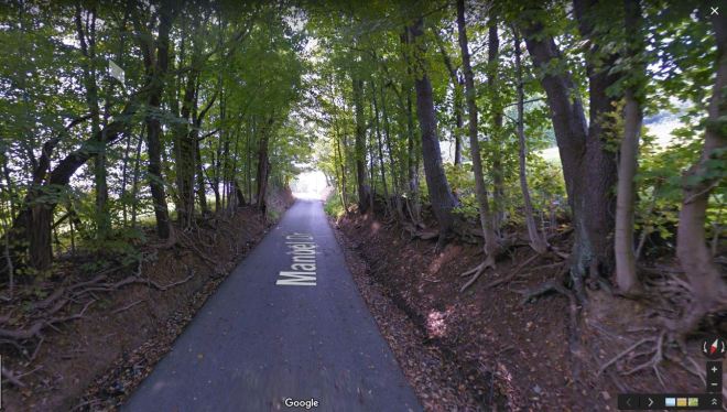
Manley Chapel Rd. is a hollow road which also functions as a main route.
However, Country Roads, like the CR56s in and around Monongah, are a hit-or-miss; if they are paved, they probably don’t have lines as they typically get the most minimal of maintenance and the Google Maps car probably can’t get clear pictures on such bumpy roads. A real Country Road is more like a permanent scab of compressed dirt and gravel where the space for 2 cars means someone’s tires are riding the ditch.
If you watch this YouTube video of Hall Family Roadtrips you can see first hand how easy it is to get mixed up on these roads without some kind of navigating system or existing knowledge. I love this video for so many reasons:
Being from this area, the first part of this video pleases me so much as the driver ‘hits every light’ at just the right time along Fairmont Ave. You don’t realize how rare that is until you’ve worked food delivery service in that place.
It is a brilliant live example of what I’m trying to explain. If you look at the far right of the map above, where the yellow line turns over the word “Fairmont”, and start this video at 2:06 you can follow along on the map as they drive. Except…
This poor driver gets sucked into the “Country Club Trap” at 3:28. Now, this is great for you and me because it gives you a glimpse of what I mean by “hollow-holler-hollow” road systems. Notice how the road changes with its surroundings. The deeper you get into the hollow the more it starts to resemble a holler as the road narrows, the lines go away, and forest surrounds you more than residences.
Snapshot from the Hall Family video
Then, at 4:40, we get dropped back out next to the West Fork River on Rt. 19, exactly where we would have ended up minutes earlier if the driver had just stayed straight at the light and not turned right onto a hollow/holler road.
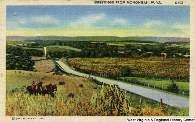
From there, you are on your way into the west side of Monongah. At 5:20, the driver passes the ‘mouth’ of Mill Fall Run on the right. At 5:32 of this video, you pull into Monongah where Rt. 19 is known as Camden Ave (because it predates the existence of Rt. 19) and it really is a blast from the past. Below is a postcard of Camden Ave around the turn of the 20th century on top of a snapshot of Camden Ave today.
Snapshot from Hall Family video
At 5:50, the driver stops to turn on GPS or at least check a map right smack in the middle of Monongah, which isn’t uncommon. Monongah itself is so twisty and turny with so many ins and outs that travelers tend to get wary about making another wrong turn beyond this point. We have a saying that, “all roads lead to Monongah; you just gotta know where to turn”.
Hollow roads are sometimes several miles long and if you can navigate these Country Roads just right they can be a shortcut to the other side of the county, they can connect to other hollows, or they can take you to someplace even more awesome…
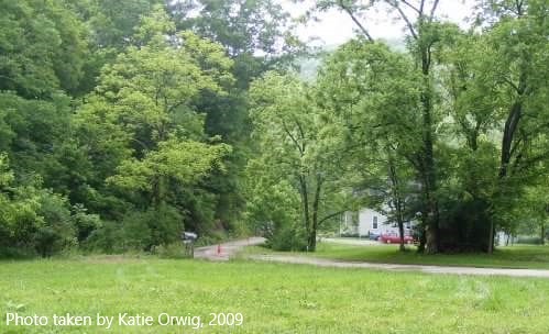
Along Manley Chapel Rd., another road branches off to the left. This is Manuel Dr. – a holler road.
A holler is a very special place. One can only get to a real holler in a vehicle by correctly navigating the hollow. Sometimes you can only find the holler if you have been personally invited by its occupants as only they know the ways in and out. Other times, you may need to hike, bike, and/or boat your way there.
The holler is just an area past the hollow. The holler is a far more isolated place because it sits deeper in the mountains, typically below the hollow but still above the valley and can be impossible to navigate. In the right areas of the state, you can find hollows or hollers with a full rapid river, like Ten Mile in Buckhannon. In the greater Monongah area, our hollers are more likely to have nothing more than a crick which may be elevated to creek status only after heavy rains.
Where valleys typically have rivers or streams, a hollow may have nothing more than a run or brook/creek, and a holler will usually only have a crick– which, in some cases, is only around after heavy rains as it is nothing more than a natural drainage path for runoff rainwater.
Manuel Dr. is a beautiful example of a holler road
You may have heard that the holler gets its name from the fact that all one must do to talk to your neighbor on the adjacent hill is simply “holler” at them. Well, that can happen in hollows too. That factor is more of a coincidence which just helped the term stick as a general title. True, in the average holler you can talk to a neighbor over hundred of yards away as if they were on your own porch, but this isn’t true for all hollers or hollows.
In a steep valleyholler with a large waterway, like those in the southern part of the state near the New River Gorge, it doesn’t work as well. The white noise of the flowing river paired with the air currents of the valley can ‘take your words with the wind’. However, in small ‘backwoods’ hollers where the natural landscape mimics that of a Greek or Roman amphitheater, voices or other sounds can carry with such ease that hollerin’ is unnecessary overkill.
In the early years of my childhood, before the days of 24 hour news channels and shows like America’s Most Wanted and Unsolved Mysteries, being a kid meant being home by the time the streetlights came on and always staying within “hollerin’ distance”. The landscape of any area will determine what counts as “hollerin’ distance” – the distance a good hearty shout will travel across the landscape to the ears of another person. Basically, if the adults couldn’t hear you and you couldn’t hear them, then you were out of “hollerin’ distance” and you were in real trouble.
The Waterways
We have the same types of terms everyone else has for their natural water systems. But, naturally, we have a hierarchical system in place so we can get quite specific with them too as it is another special part of our navigation system.
Though West Virginia can boast many lakes, both natural and man-made, our most important water sources are our rivers.
The River
Rivers were the main navigation tool in the mountains from the earliest days. The Ohio River makes up our western most border, the Potomac defines our eastern panhandle, but it is the Monongahela River which is believed to have flowed the first of the indigenous groups (Native Americans) into the north central mountain area from the Delaware region centuries, possibly even thousands, of years ago.
Monongahela is a very specific and descriptive word on its own. Surprisingly, Wikipedia has the best and most concise description of this word:
The Unami word Monongahela means “falling banks”, in reference to the geological instability of the river’s banks. Moravian missionary David Zeisberger (1721–1808) gave this account of the naming: “In the Indian tongue the name of this river was Mechmenawungihilla (alternatively spelled Menawngihella), which signifies a high bank, which is ever washed out and therefore collapses.”[11]
The Lenape Language Project renders the word as Mënaonkihëla (pronounced [mənaoŋɡihəla]), translated “where banks cave in or erode”,[12] from the verbs mënaonkihële “the dirt caves off” (such as the bank of a river or creek, or in a landslide)[13] and mënaonke (pronounced [mənaoŋɡe]), “it has a loose bank” (where one might fall in).[14]
Monongalia County and the town of Monongah, both in West Virginia, are named for the river, as is the city of Monongahela in Pennsylvania. (The name “Monongalia” is either a Latinized adaptation of “Monongahela” or simply a variant spelling.)
A “high” “loose” “falling” bank along a river where the dirt “is ever washed out” and therefore “caves in” and one treading along it “might fall in” to the river below. Yep, sounds like the West Fork in Monongah!
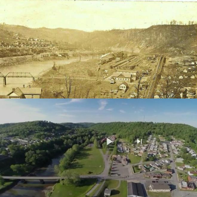
Oddly, Monongah does not sit along the Monongahela River. She is tucked away in a little and hard to access valley along the West Fork River which was only passable by anything more than a small boat during flood seasons until the railroad came along. However, her luck of having such abundant coal reserves and being so close to the Monongahela River, yet still so very isolated from ‘society’ in Fairmont, made her the “gem” of the Fairmont coal field.
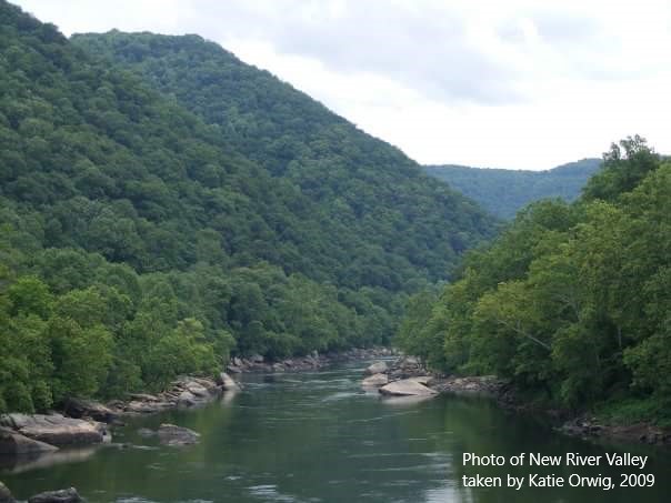
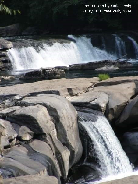
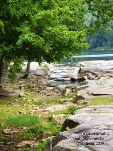
Some rivers are calm, others are rapid like parts of the Tygart Valley River which flows through and continues to carve the falls at Valley Falls State Park
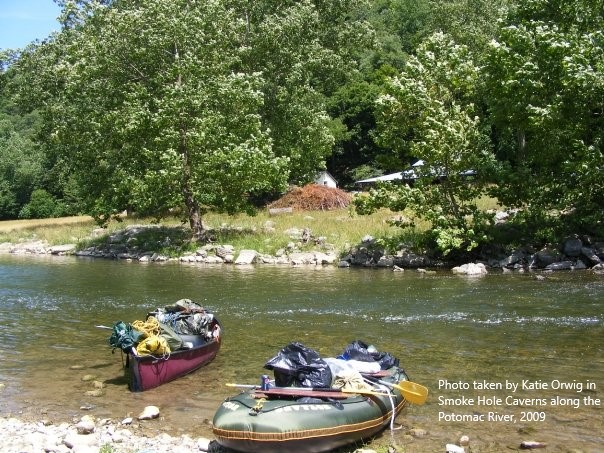
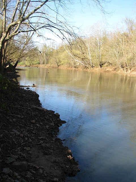
The Stream
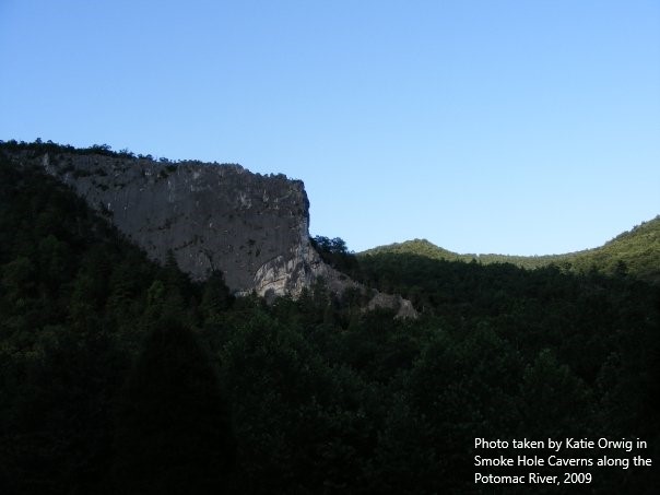
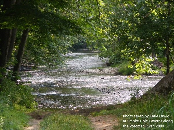
Streams are just smaller and more narrow rivers. In the mountains, a stream could be a few different things. It could be the classification given to a section of a major river which is just so low at a certain point that the river bed can be seen and the water literally streams at a slower rate, causing the river rocks to create tiny rapids, like in the photo of a section of the Potomac River above. This could be the norm for certain parts of rivers due to their natural elevation or it could just be as a result of drought and, therefore, only temporarily low.
The photos above are an example of a stream being a small runoff branch of a larger and more powerful river nearby. In areas around the Valley Falls portion of the Tygart Valley River, these little streams can be found cutting into the landscape here and there along the banks. They often have a steady supply of water but some will travel up the landscape and then they could turn out to be something else…
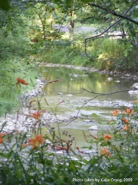
The Run
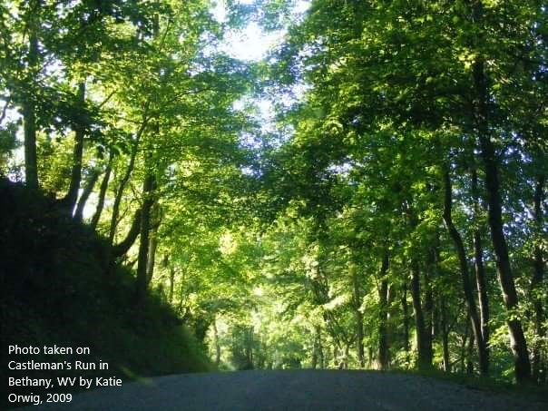
Castleman Run branches off of Buffalo Creek in Bethany, WV. This is where I would come to study while attending Bethany College.
A run is a just a small stream which holds a very special quality: its path stretches up from the main river into the higher landscape surrounding the main valley. A run is sort of half stream-half brook; it has a ‘mouth’ in the valley fed by the flow of the river like a stream but, it’s areas of higher elevation are natural rainwater runoff paths which act more like brooks carrying rain water down to the ‘mouth’ to be dumped back into the river. As a result of this natural drainage system, runs can be notorious for flash floods.
A run can take you deeper into the landscape or lead you out which explains why many hollows follow along runs- it runs water in a more direct path from higher elevations to the valley below. That is also why the word “run” is typically included in the names of places like this but, at one point, runs in these mountains took on a very special alternative meaning to certain people.
Due to their nature, runs were very significant in the times of the Underground Railroad when survival or freedom meant knowing that you need to follow the brook to the run through the hollow then wait at the ‘mouth’ to the river in the valley. Follow the creek or crick by mistake and you could end up going deeper into the landscape and fall into the hands of the wrong neighbor who will have no qualms about letting bounty hunters know about this secret little ‘through-way’ for escaped slaves.
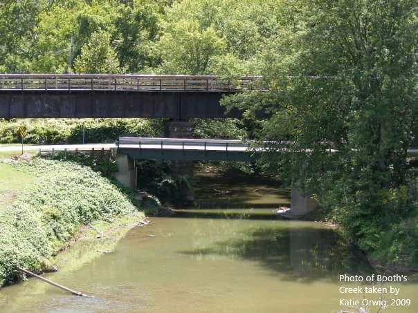
The Brook/Creek
Brook is often interchangeable with creek but, again, in the mountains we have to be a little more specific sometimes. Brooks and creeks are just small streams. They can be their own entity and carry water from a highland directly down to the valley below or they can feed into a run or stream. There is no exact science in determining the difference between a brook and a creek other than observing elevation and even that is hit-or-miss depending on the landscape.
However, if you had to try and take a guess and determine if you are beside a creek or a brook the first thing to do is look and listen to the water. Does it look like it is flowing with gravity? Does it sound like a cup that’s slightly overflowing in your sink, the little trickle of water falling down sort of ‘babbles’ as it runs down and hits the bottom? Then it’s a probably a brook.
Or, is the waterway rather level for the most part? Does it serpentine through the landscape, occasionally rising and falling while it twists and turns? Does it sound a little more like water pouring out of a hose than a container overflowing? Then it’s probably a creek which is typically found on slightly lower elevations and it’s flow has less to do with gravity and more to do with water pressure.
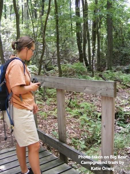
The Crick
Last but not least we have the crick. Now, cricks aren’t always there in the form of water but their path is still a permanent gouge in the landscape. More often than not, cricks only really flow after heavy rains.
My friend, Becky, evaluating the crick below. If you look closely, you can see there is some water in there but the gap that remains in the land is the real reason for the footbridge