“Stunned by the terrible swiftness of the wings of the angel of death over the little coal mining village, Monongah is today dumbly counting its dead.” (EO 12.7.07 pg. 1)
Dawn
In Monongah:
“The excitement of the day was no less keen, but not of the noise and demonstration of the morning, the people awakening to the awful loss of life and being ready to offer everything within their power to aid the work of rescue.” (CDT 12.7.07. pg. 1)
“With the dawn of day there began a heartrending march up and down the aisles along which these bodies have been laid, by sobbing wives and mothers and sweethearts, orphaned children and strong men, each seeking a near relative or beloved friend.” (News)
“Tomorrow or the next day the numbed nerves may again perform their functions and in the reaction the survivors may writhe in grim agony and grief, but today there is no sorrow—only dull interest that lights up eyes of mothers, wives, and brothers as each limp and blackened form is tenderly passed up from out of the hell pit, where in one brief moment 400 lives were snuffed out as a candle light in a gale.” (EO 12.7.07 pg. 1)
“All with the exception of a few have given up hope and accept it as a foregone conclusion that none survive the disaster. Relatives still cling to the ray of hope, however, that their loved ones may have been spared and eagerly seek the reports of the searchers as they come above to get fresh air.” (CDT 12.7.07 pg. 1)
~6:00 am – ~ 8:00 am
At #8:
“Fire…in south side of #8 was extinguished about 6 o’clock this morning.” (FWV 12.7.07 – pg.1)
Rescue and recovery work can finally begin in #8.
At the mines:
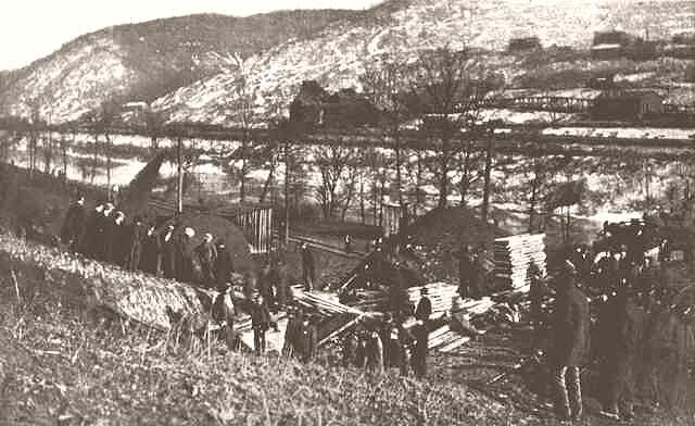
Rescue work has become thoroughly systemized and progresses rapidly. “Hundreds of men are at work this morning clearing away the debris for the removal of the 425 unfortunate men whose lives were snuffed out without a moment’s warning.” (FWV 12.7.07 pg. 1 – noon)
“With unabated energy, five rescuing parties, working from every possible point to enter and explore mines numbers 6 and 8…are this morning putting forth every effort to reach, dead or alive, the remainder of the 400 or more men who went into the mine yesterday morning. There is little hope that any have survived the terrific explosion and the resultant poisonous gas…” (WED 12.7.07 pg. 1) (ES 12.7.07 pg. 1)
“Near the mine entrance, when the rescue work began, were nearly 300 caskets indicating the least extent to which the company believe the loss of life in the mine will reach.” (TEP 12.7.07 pg. 1)
In Monongah:
“Men are now working in relays to reach the miners entombed in the two great shafts. On the hills overlooking their work are the weeping wives and other relatives of the imprisoned men. Among them are the three women whose husbands lie in the improvised morgue.” (WED 12.7.07. pg. 8)
“The scene at the wrecked mines is a repetition of the sight yesterday. The grief-stricken ones is deeper than manifested yesterday. The hopeful anxiety that characterized the people looking for the rescue of loved ones has changed to a sorrow well-nigh inconsolable. Yesterday there was hope today there is despair. The hope for loved ones to escape from their imprisonment to be recognized by their friends gave way to the thought of not knowing them when brought to the surface.” (FWV 12.7.07 pg. 1 – noon)
~8:00 am
In Monongah:
“Hundreds of people have been attracted here from Fairmont, Clarksburg and other places in the valley, many of them having friends and relatives among the ill-fated miners and at the scenes of the horrors are seething masses of people.” (CDT 12.7.07 pg. 1)
“Mine officials, railroad men, newspaper men of the big city dailies, craftsmen of every trade are mingling with those who are anxious about those whose lives are sure to have been snuffed out.” (FWV 12.7.07 pg. 1 – noon)
“Hundreds of visitors are at Monongah today viewing the wreckage and watching the bringing of bodies to the surface…” (FWV 12.7.07 pg. 1 – noon)
~8:30 am
“Mr. R.M. Hite offers services of a large number of experienced miners from Kingmont mines (operated by the Virginia and Pittsburg Coal Company). This was a very kind offer…for the men who have long searched for the missing are getting weary. They have searched diligently and there is an end to their endurance.” (FWV 12.7.07 pg. 1 – noon)
~9:00 am
At #6:
Another rescue party including John Hallan and Carl Tarlton enter #6, still hoping to find survivors in the very recesses of the mine.
Not long into their exploration, Hallan and Tarlton find the body of a motorman, “jammed back in the motor where he had been sitting with one arm thrown about 30’ away” (McAteer). As this motorman was clearly dead, they did not stop for long to examine him and continued on their search, looking for any dangerous gases and any signs of life.
At #8:
Rescue parties also prepare to enter #8 with the same purpose: find survivors.
“In mine number 8 the rescuers are just getting to work as gasses have delayed them.” (EO 12.7.07 pg. 1)
“Six bodies are all that had been found in No 8 until this morning. One man was found in the manway.” (FWV 12.7.07 pg. 2 – noon)
In Monongah:
25 more miners arrive in Monongah from the Tunnelton mines to help rescue efforts. (FWV 12.7.07 pg. 1)
“The King’s Daughters and committees of women started a work of visiting homes of the miners, leaving baskets of food where needed…” (Kellogg)
Restaurants in Fairmont and Clarksburg made soups and sandwiches for rescue workers and victim’s families “…and two blacksmith shops were turned into kitchens where great pots of stew and coffee were set boiling.” (Kellogg) People from all around have been bringing whatever they have for donations.
Father D’Andrea of the Italian Catholic Church, Our Lady of Pompeii, is certain by now that his own brother, Victor D’Andrea, is among the victims of the disaster. However, he gets no time to mourn as he and other religious leaders have been overwhelmed with the grief-stricken families for the last 24 hours. Father D’Andrea is only now beginning to survey victims among his parishioners while Father Lekston of St Stanislaus Catholic church has already counted at least 110 victims from his Polish congregation.
In Fairmont:
A little after 9 am, C.W. Watson telegraphs J.N. Camden, “…have lost all hope of finding any men alive.”
~10:00 am
“At ten o’clock today, a total of one hundred bodies had been found in the Monongah mines. These will be removed to morgues at once. Four hundred coffins have been ordered by the Fairmount Coal company. All will be used sooner or later, as it may be weeks before all victims of the explosion are recovered.” (RP 12.7.07 pg. 1)
“The remains of the dead are being carefully handled and prepared for burial in the most decent way even as well as could be done at a well-regulated undertaking establishment.” (FWV 12.7.07 – pg.1)
~11:00 am
In Monongah:
“The eleven o’clock car was one hour getting through the dense crowd between Nos 8 & 6.” (FWV 12.7.07 – pg.1)
“There is an immense concourse of people all anxious to see what there is to be seen. While the situation has not reached that point yet it may be possible that it will have to be brought under military control.” (FWV 12.7.07 – pg.1)
“President C.W. Watson wired Gov. Dawson this morning that he did not think military control would be necessary as the crowd is a very orderly one.” (FWV 12.7.07 – pg.1)
Outside the mines, Doctors Hill and Cook along with a few dozen nurses realize their services won’t be needed for survivors but for the rescuers instead. A second emergency hospital is set up by #8 and equipped “at 11 o’clock today with cots, bedding, and etc.” (FWV 12.7.07 – pg.1)
At #6:
“Up to 11 o’clock today sixteen bodies had been removed…Four are Americans. About eighty bodies have been found, but only sixteen have been brought to the surface.” (WED 12.7.07 pg. 1) (RIA 12.7.07 pg. 1)
“The rescuers are now within 1,500 feet of the end of the mine. They are working in two parties of about thirty men each with reliefs every hour.” (WED 12.7.07 pg. 1) (RIA 12.7.07 pg. 1)
Outside #8:
2 members of rescue crews, Milton Coburn and James Kane, are taken out of #8 to the emergency hospital set up just below the opening of the mine. Both were overcome by the gasses they inhaled while inside. (FWV 12.7.07 pg. 1)
J.H. Leonard and Alonzo Shroyer are staring down the portal of #6 mine, bracing for the imminent impact of the runaway train of coal cars. Inside the #6 fan house, the clock connected to the sensitive pressure gauges of the fan marks that at 10:30 am the gages “go up a little then drop clean to the bottom” (Inquiry, Victor).
Somewhere in the deep recesses of the two mines, a massive explosion erupts. As it tears through the workings of the mine, following the paths of least resistance, it consumes all oxygen, extinguishes the carbide lamps of the miners, and destroys most of their belongings.
Many men within the mines die instantly as a result of traumatic injuries such as burns, blunt force impacts, and decapitation. Others get caught up in the blast and carried away as, “Every movable object shot with terrific force through the mine.” Majority if not all of the workers caught in this wave are utterly demolished, several of their bodies will be found “strewn at the mouth” or not found at all, having been disintegrated in the force. (Nurses) (LAH 12.8.07 pg. 1) (McAteer)
Inside #8 mine:
The DePetris brothers are violently thrown off their feet, the blast hurling them against a rib then to the mine floor. (McAteer, Inquiry)
Nearby, Dan Dominico is smashed to the ground with such force that his ear is badly cut and one arm is injured so seriously he cannot move it. (McAteer, Inquiry)
Outside #8 mine:
The south-bound interurban trolley is only a few yards beyond the mouth of mine #8 when the crowd of passengers begin to feel and hear the earth rumble around them. (News)
On the East side of Monongah:
George Peddicord has barely begun to cross the Iron Bridge between the two mines when he feels everything around him shake and hears a rumbling noise from up river, in the direction of #8. (Inquiry)
At the Traction Park Interurban station between #6 & #8:
George Bice is around 330 yards north of #8, by the Traction Park interurban station when he hears the report, “likened to the discharge of a cannon,” from behind. He spins around to look at #8 and sees tons of brick, 8×8 timbers, infrastructure, machinery, coal cars, tools and other debris from deep within the mine hurled up and out the entrance by the explosive force. The miners’ check-tag board is eviscerated, the brass ID tags scatter into the river and are lost. (McAteer, Inquiry, News)
At #8:
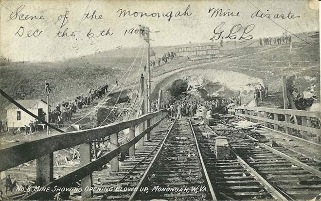
The large iron gate at the mouth of #8 is ripped away as the force exits through the mine mouth. But the pressure is simply too much and the force tears a 100-foot hole in the hillside where the entrance once stood, tossing the iron gate and chunks of concrete, one “weighing fully 1000 pounds”, across the river and embedding them into the eastern river bank. (McAteer, Inquiry, News)
“So great was the force of the explosion that one man was blown out of a pit mouth a distance of 400 feet.” (WT 12.7.07 pg. 1) Charles Honaker is caught by the first blast wave at the entrance of #8. His clothing is “lit ablaze” and his body is hurled into the air along with the debris and blown hundreds of yards away, toward the river. (McAteer)
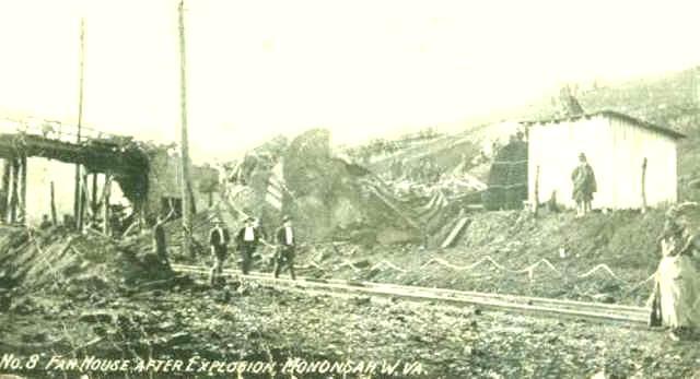
The 10 ton, 30’ tall fan for #8 is considered one of the most powerful fans in the country. It is ripped from its concrete moorings, chucked across the river, and embedded in a hillside almost a half mile away from its original location. The large powerhouse, with all its large machinery and boiler room is blown all the way to other side of the river. (McAteer, News, Inquiry)
Electric wires about the mouth of #8 mine are ripped apart and strewn across the ground. (News, Inquiry)
Across the river at #8 tipple:
Otto Smith yells out to the #8 tipple boss, “I reckon the mine has blown up!”. He turns around to see a plume of fire and smoke shoot from the open hillside of #8 more than 60 feet into the sky. (Inquiry)
In the vicinity of #8:
Windows shatter in the buildings around #8, including those all the way across the river in the house next to the tipple. Hyre Stalnaker hears the blast inside the carpenter shop and attempts to run outside but the shock of the blast throws him back into the shop and knocks him out. (Inquiry, News, McAteer)
In the center of town:
George Peddicord can not see the #8 portal from his position on the Iron Bridge, but the force is so intense he can see the timbers and debris flying above through the air followed by a tower of black smoke. (Inquiry)
In Monongah:
Lester Trader was in bed, though not yet asleep, when “the whole house lifted, then the sound of a terrible roar and I felt the earth shaking with such intensity causing objects to fall from shelves…”. He rises from bed and races for the door.
Almost instantly, before Lester Trader can make it to his door, a second report comes from down river in the direction of #6. When he reaches his door, he can feel the wind still coming off of #8. (Inquiry, McAteer)
Inside #8:
Dan & Leo Dominico and the DePetris brothers are just getting to their feet when they are knocked down again by a second, equally powerful explosion. (Inquiry)
Peter & Stan Urban hear and feel the second explosion; they begin to run. (Inquiry, McAteer)
On the East side of Monongah:
Christina Cerdelli hears the noise of the blast in her doorway. She sees smoke coming from the toad holes all along the west side. The smoke is so thick and abundant some believe it is coming from St. Stanislaus Catholic Church. A bit farther up river, Lee Curry also sees the smoke above houses and St. Stanislaus on the west side of town from his vantage point on the #8 tipple. (Inquiry)
Beneath the #6 tipple, E.P. Knight hears something that sounds like dynamite with “a roar to it” come from #6.(Inquiry)
At #6:
Tons of earth are heaved high into the air around #6 and adjacent buildings are damaged. (News, Inquiry, McAteer)
At the mouth of #6, J.H. Leonard and Alonzo Shroyer are thrown back as the blast exits through the portal. Leonard is covered in rubble; his arm and ankle are very hurt. Shroyer slams into something hard, possibly the derailing switch, cutting him to the bone behind his right ear. (Inquiry, McAteer)
A piece of rail track comes down into the #6 blacksmith shop though the blacksmith, Will Jenkins, only sees a sootish-colored smoke with no flame coming from #6 in a steady blowout. (Inquiry)
Pat McDonald, who was still running toward #6 on the trestle, is also hurled over 100 feet backwards and badly injured. (Inquiry, News, McAteer)
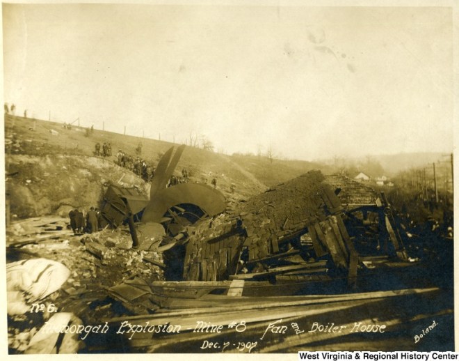
The top of the #6 fan house is “blown in the air a considerable distance”, more than 400 feet. (FWV 12.6.07 pg. 1)
Ed Fry is in the doorway of #6 engine room when he is physically jarred by the second blast, though he hears no report. (Inquiry, McAteer)
On the East side of Monongah:
E.P. Knight is still on the telephone with John Talbott until he glances out his shanty window, then runs out the door to see a good bit of dark brown smoke coming out of the #6 air shaft. On the other end of the line, inside the company offices, John Talbott heard the report and saw the flash of fire at #8 through the 2 large bay windows in his office which faced both mines.(Inquiry, McAteer)
The outside foreman, Charlie Dean, and Superintendent of #6, A.J. Ruckman, are talking in the company offices in Monongah when they feel the building shake from the concussion. The loud report causes Charlie Dean to assume that the #8 boiler has blown up. A.J. Ruckman, looks out to #6 and sees smoke coming out of the air shaft “strong, under high pressure”. (Inquiry, McAteer)
Frank Morris feels the jar in his office inside the company store. He runs outside to see smoke coming out of the mouth of #6 and begins running toward the mine. (Inquiry, McAteer)
At #6:
J.H. Leonard does his best to crawl away from the #6 portal to an area where he could let himself down under the trestle and protect himself from flying debris with the door from a coal car. (Inquiry, McAteer)
In the center of town:
George Peddicord drops his buckets and rushes across the Iron Bridge, not to the mine, but to his home. (Inquiry, McAteer)
At #8:
The interurban trolley is rocked on its tracks by the concussion, but holds its bearings and continues on with a crowded car of stunned and terrified passengers. (News, McAteer)
In the surrounding areas:
The “shock from the explosion was distinctly heard” 12 miles away in Pruntytown. (FWV 12.7.07 – pg.1)
The concussion is reportedly heard up to 50 miles away and is “distinctly felt” in Grafton and in the school house at Hoult where the “erasers were jarred from the blackboard and struck to the floor with a bang.” (WED 12.7.07 pg. 8) (FWV 12.12.07 pg. 2)
“People for miles in every direction begin to make inquiries over the telephone…” (FWV 12.7.07 pg. 1 – noon)
Lee Lichtenstein of Columbus was 6 miles away in Fairmont at the time. He will later tell The Baltimore Sun that, “The explosion shook Fairmont…as if by earthquake…a rumbling noise, houses rocked to and fro, people rushed wildly to the street and it was 15 minutes before it was known what occurred.” (News, McAteer)
In the town of Monongah:
No one in Monongah needed to ask what had happened. “They divined instantly that another great mine horror had taken place.” (WED 12.7.07 pg. 8)
The sounds of the blasts were deafening. “The buildings of the cities tottered and waved as if they would collapse. The pavements were upheaved and some of the frailer structures fell into ruins.” (WED 12.7.07 pg. 8)
“Pedestrians and even horses were knocked off their feet… Fires started in various parts of the city.” (WED 12.7.07 pg. 8)
“In the shock of the explosion the school house at Monongah was shaken in such a way that it threw the children in a frenzy and they rushed to the doors and windows some thinking an earthquake had occurred. When the smoke from the mines was seen an uproar was started as it was then realized what had happened. Children screamed pitifully that their fathers were killed and the teachers were utterly unable to control them.” (FWV 12.10.07 pg. 8)
There are several reasons why Appalachians have their own special language about their land. The most prominent reason is that ‘proper’ English simply isn’t good enough to help with navigation. Those basic terms work just fine in the foothills and the flatlands, but deep in these ranges and forests we need to get a little more specific so we don’t end up on the wrong side of the mountain. So, we tend to make up our own words or adapt existing words to take on a new or more specific meaning which is why terminology will differ depending on where you go in Appalachia.
Terminology matters just as much today as it did in the times before GPS and vehicles. Mostly because this terminology is included in the names of many places, like Mill Fall Run, and if you lose your satellite reception (which will happen in certain parts) knowing your terminology can help you “get to where you need to get” all on your own just like the early settlers or those on the Underground Railroad.
The layout of Monongah and its surrounding area is a perfect example of the terminology and its relevance. I am a ‘visual’ person so I will use lots of pictures to get you familiar with our terminology as it applies to this little town, its people and the surrounding areas.
GEOGRAPHY
Land
Well, just in case you didn’t already know, we are located in the Appalachian Mountain range which extends from the deep south all the way up into Canada on the east coast. West Virginia is the only state completely engulfed by this range. Even when we were part of Virginia, they still referred to us as “Western Virginia” and, basically treated us with the same indigence. We were those rugged, backwoods “Mountaineers” who lived off the land with only the very basics and enough to ‘care for our own’. The proper English folk of the Colonies had no use for us if they couldn’t profit from us so, the area was mostly neglected and remained severely isolated from ‘society’ until coal was discovered. By that time, we had developed our own complex language and various dialects to accommodate our environment. Despite the best efforts of the “Americanization” process of the early 20th century, that language still thrives today and it helps to know the very basics.
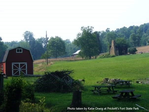
This photo is of the Morgan Cabin at Prickett’s Fort State Park only a few days after an arson incident when the old pioneer house was set on fire.
The Valley
Valleys are elongated lowlands between other uplands along major waterways and typically play permanent host to major cities or towns. Therefore, they are more populated and hold most of the resources for the area. Monongah sits in a valley along the West Fork River. At the time all of the ‘official’ mapping and naming was going on, we were included as part of the Monongahela/Tygart Valley Region. This probably explains why most of Monongah’s earliest settlers got their land by tomahawk rights.
If you love history and old photos, I highly suggest browsing the extensive online collection of the West Virginia & Regional History Center at WV Dept. of Arts, Culture, and History
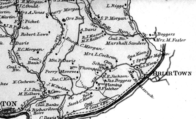
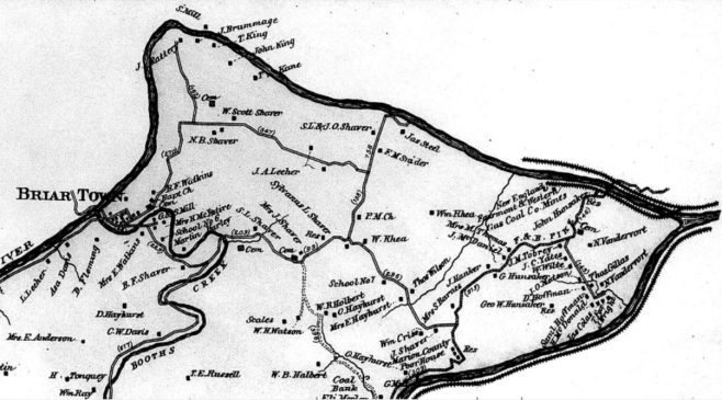
When it comes to the time of tales like ‘Coffin Hollow’, this place was still just a collection of isolated farmers in a small hollow known as Briar Town. Once transport to and from the hollow was established via railroad, bringing industry and a population boom to the area, her status was upgraded to valley and the hollow known as Briar Town became the town of Monongah – a suburb of the city of Fairmont.
These are screenshots of a map of the area from 1886. The East side of Briar Town is in the Grant District. The West side of Briar Town is in the Lincoln District. Link to the website where these maps can be viewed or purchased are in description
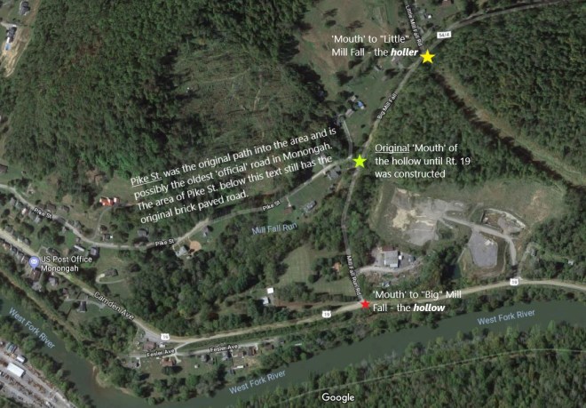
The Hollow
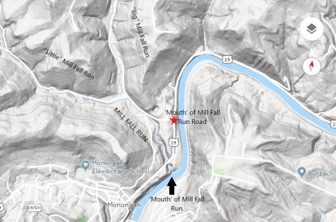
Hollowsarevalleys – an area of land that has been drained or irrigated over time by a water system which may or may not still exist; the second definition of the word valley. The key difference is that a hollow is located on higher ground within the landscape surrounding what is considered to be THEvalley. Though the ‘mouth’ of the hollow may be located in thevalley, it’s typically not the only way in or out. It’s simply the most direct way into the hollow from the main road or path which almost always follows along the main valley and its waterway, hence the term ‘mouth’.
It’s all about navigation.
The most important thing to know about what constitutes a hollow these days, is its road system. In a city, rather than walking all around the block to get to the next street, you may try to cut through an alley or ‘backstreet’ because the shortest distance between two points is a straight line, right? But, you will use caution because alleys are notorious for their potential dangers and a wrong turn can send you in the worst direction. Hollows are just like alleys.
Hollows can usually be determined by the width and conditions of their roads. An existing and mapped road wide enough for two cars to pass side by side, though it may be a tight squeeze, is your typical hollow road. The ‘mouth’ of the hollow is often paved but it doesn’t always stay that way throughout. Main routes which pass through hollows are paved, painted, and mapped by Google Earth like any typical road these days.
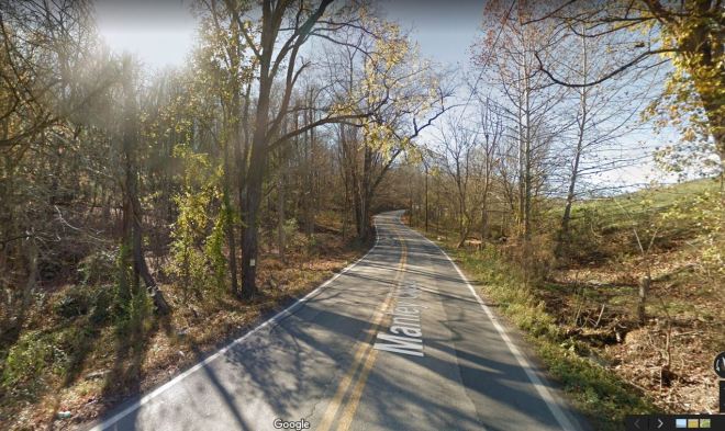
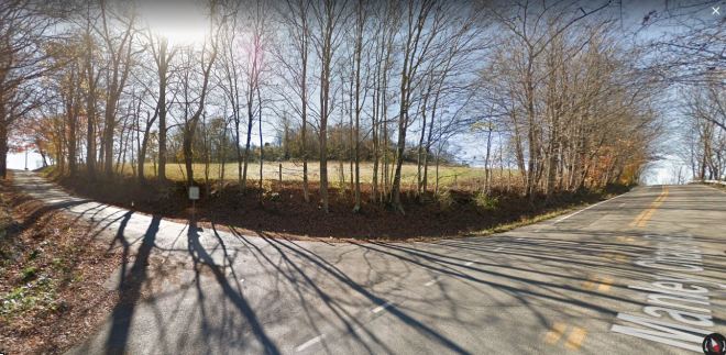
Manley Chapel Rd. is a hollow road which also functions as a main route.
However, Country Roads, like the CR56s in and around Monongah, are a hit-or-miss; if they are paved, they probably don’t have lines as they typically get the most minimal of maintenance and the Google Maps car probably can’t get clear pictures on such bumpy roads. A real Country Road is more like a permanent scab of compressed dirt and gravel where the space for 2 cars means someone’s tires are riding the ditch.
If you watch this YouTube video of Hall Family Roadtrips you can see first hand how easy it is to get mixed up on these roads without some kind of navigating system or existing knowledge. I love this video for so many reasons:
Being from this area, the first part of this video pleases me so much as the driver ‘hits every light’ at just the right time along Fairmont Ave. You don’t realize how rare that is until you’ve worked food delivery service in that place.
It is a brilliant live example of what I’m trying to explain. If you look at the far right of the map above, where the yellow line turns over the word “Fairmont”, and start this video at 2:06 you can follow along on the map as they drive. Except…
This poor driver gets sucked into the “Country Club Trap” at 3:28. Now, this is great for you and me because it gives you a glimpse of what I mean by “hollow-holler-hollow” road systems. Notice how the road changes with its surroundings. The deeper you get into the hollow the more it starts to resemble a holler as the road narrows, the lines go away, and forest surrounds you more than residences.
Snapshot from the Hall Family video
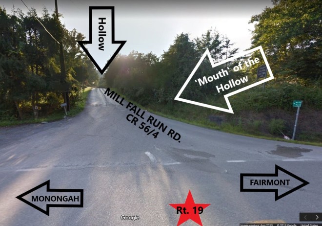
Then, at 4:40, we get dropped back out next to the West Fork River on Rt. 19, exactly where we would have ended up minutes earlier if the driver had just stayed straight at the light and not turned right onto a hollow/holler road.
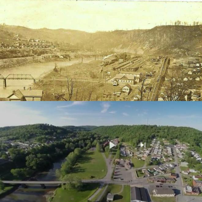
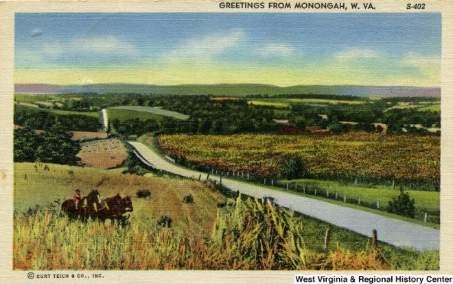
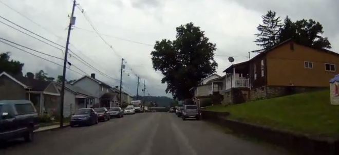
From there, you are on your way into the west side of Monongah. At 5:20, the driver passes the ‘mouth’ of Mill Fall Run on the right. At 5:32 of this video, you pull into Monongah where Rt. 19 is known as Camden Ave (because it predates the existence of Rt. 19) and it really is a blast from the past. Below is a postcard of Camden Ave around the turn of the 20th century on top of a snapshot of Camden Ave today.
Snapshot from Hall Family video
At 5:50, the driver stops to turn on GPS or at least check a map right smack in the middle of Monongah, which isn’t uncommon. Monongah itself is so twisty and turny with so many ins and outs that travelers tend to get wary about making another wrong turn beyond this point. We have a saying that, “all roads lead to Monongah; you just gotta know where to turn”.
Hollow roads are sometimes several miles long and if you can navigate these Country Roads just right they can be a shortcut to the other side of the county, they can connect to other hollows, or they can take you to someplace even more awesome…
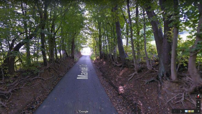
Along Manley Chapel Rd., another road branches off to the left. This is Manuel Dr. – a holler road.
A holler is a very special place. One can only get to a real holler in a vehicle by correctly navigating the hollow. Sometimes you can only find the holler if you have been personally invited by its occupants as only they know the ways in and out. Other times, you may need to hike, bike, and/or boat your way there.
The holler is just an area past the hollow. The holler is a far more isolated place because it sits deeper in the mountains, typically below the hollow but still above the valley and can be impossible to navigate. In the right areas of the state, you can find hollows or hollers with a full rapid river, like Ten Mile in Buckhannon. In the greater Monongah area, our hollers are more likely to have nothing more than a crick which may be elevated to creek status only after heavy rains.
Where valleys typically have rivers or streams, a hollow may have nothing more than a run or brook/creek, and a holler will usually only have a crick– which, in some cases, is only around after heavy rains as it is nothing more than a natural drainage path for runoff rainwater.
Manuel Dr. is a beautiful example of a holler road
You may have heard that the holler gets its name from the fact that all one must do to talk to your neighbor on the adjacent hill is simply “holler” at them. Well, that can happen in hollows too. That factor is more of a coincidence which just helped the term stick as a general title. True, in the average holler you can talk to a neighbor over hundred of yards away as if they were on your own porch, but this isn’t true for all hollers or hollows.
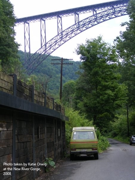
In a steep valleyholler with a large waterway, like those in the southern part of the state near the New River Gorge, it doesn’t work as well. The white noise of the flowing river paired with the air currents of the valley can ‘take your words with the wind’. However, in small ‘backwoods’ hollers where the natural landscape mimics that of a Greek or Roman amphitheater, voices or other sounds can carry with such ease that hollerin’ is unnecessary overkill.
In the early years of my childhood, before the days of 24 hour news channels and shows like America’s Most Wanted and Unsolved Mysteries, being a kid meant being home by the time the streetlights came on and always staying within “hollerin’ distance”. The landscape of any area will determine what counts as “hollerin’ distance” – the distance a good hearty shout will travel across the landscape to the ears of another person. Basically, if the adults couldn’t hear you and you couldn’t hear them, then you were out of “hollerin’ distance” and you were in real trouble.
The Waterways
We have the same types of terms everyone else has for their natural water systems. But, naturally, we have a hierarchical system in place so we can get quite specific with them too as it is another special part of our navigation system.
Though West Virginia can boast many lakes, both natural and man-made, our most important water sources are our rivers.
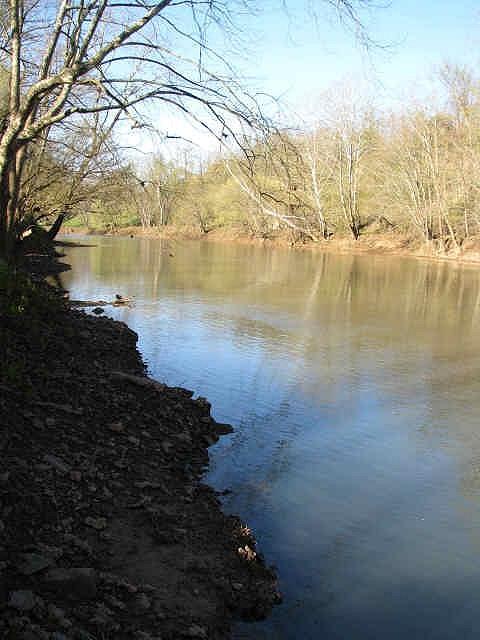
The River
Rivers were the main navigation tool in the mountains from the earliest days. The Ohio River makes up our western most border, the Potomac defines our eastern panhandle, but it is the Monongahela River which is believed to have flowed the first of the indigenous groups (Native Americans) into the north central mountain area from the Delaware region centuries, possibly even thousands, of years ago.
Monongahela is a very specific and descriptive word on its own. Surprisingly, Wikipedia has the best and most concise description of this word:
The Unami word Monongahela means “falling banks”, in reference to the geological instability of the river’s banks. Moravian missionary David Zeisberger (1721–1808) gave this account of the naming: “In the Indian tongue the name of this river was Mechmenawungihilla (alternatively spelled Menawngihella), which signifies a high bank, which is ever washed out and therefore collapses.”[11]
The Lenape Language Project renders the word as Mënaonkihëla (pronounced [mənaoŋɡihəla]), translated “where banks cave in or erode”,[12] from the verbs mënaonkihële “the dirt caves off” (such as the bank of a river or creek, or in a landslide)[13] and mënaonke (pronounced [mənaoŋɡe]), “it has a loose bank” (where one might fall in).[14]
Monongalia County and the town of Monongah, both in West Virginia, are named for the river, as is the city of Monongahela in Pennsylvania. (The name “Monongalia” is either a Latinized adaptation of “Monongahela” or simply a variant spelling.)
A “high” “loose” “falling” bank along a river where the dirt “is ever washed out” and therefore “caves in” and one treading along it “might fall in” to the river below. Yep, sounds like the West Fork in Monongah!
Oddly, Monongah does not sit along the Monongahela River. She is tucked away in a little and hard to access valley along the West Fork River which was only passable by anything more than a small boat during flood seasons until the railroad came along. However, her luck of having such abundant coal reserves and being so close to the Monongahela River, yet still so very isolated from ‘society’ in Fairmont, made her the “gem” of the Fairmont coal field.
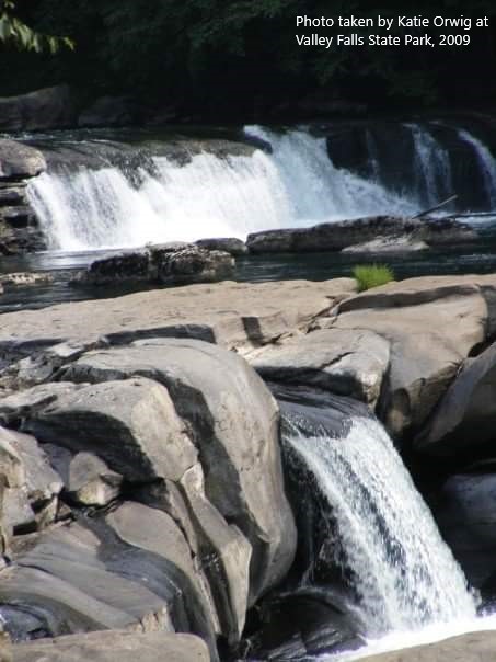
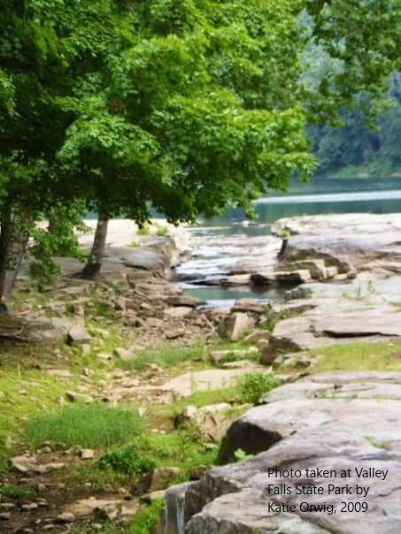
Some rivers are calm, others are rapid like parts of the Tygart Valley River which flows through and continues to carve the falls at Valley Falls State Park
The Stream
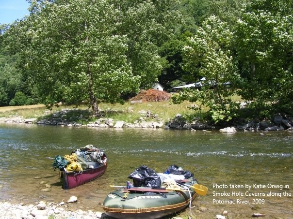
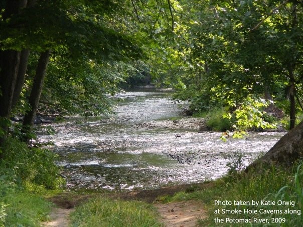
Streams are just smaller and more narrow rivers. In the mountains, a stream could be a few different things. It could be the classification given to a section of a major river which is just so low at a certain point that the river bed can be seen and the water literally streams at a slower rate, causing the river rocks to create tiny rapids, like in the photo of a section of the Potomac River above. This could be the norm for certain parts of rivers due to their natural elevation or it could just be as a result of drought and, therefore, only temporarily low.
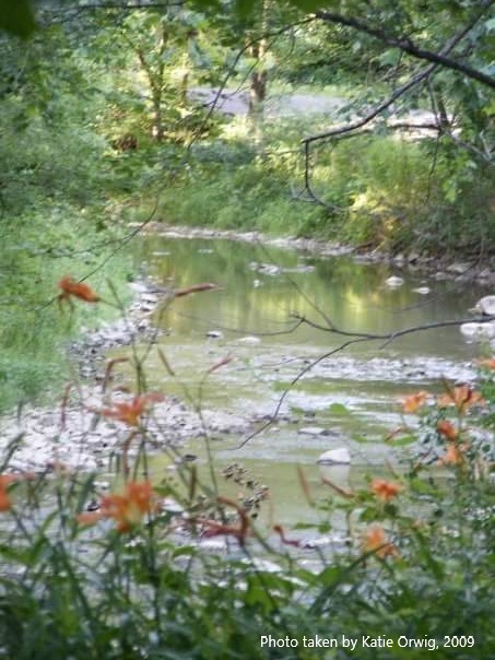
The photos above are an example of a stream being a small runoff branch of a larger and more powerful river nearby. In areas around the Valley Falls portion of the Tygart Valley River, these little streams can be found cutting into the landscape here and there along the banks. They often have a steady supply of water but some will travel up the landscape and then they could turn out to be something else…
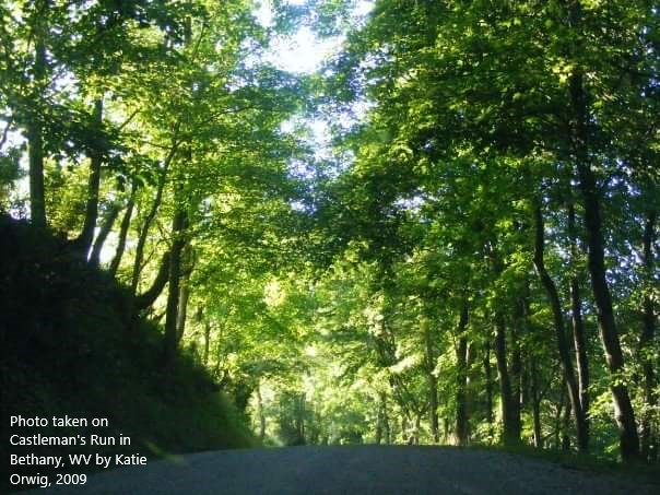
The Run
Castleman Run branches off of Buffalo Creek in Bethany, WV. This is where I would come to study while attending Bethany College.
A run is a just a small stream which holds a very special quality: its path stretches up from the main river into the higher landscape surrounding the main valley. A run is sort of half stream-half brook; it has a ‘mouth’ in the valley fed by the flow of the river like a stream but, it’s areas of higher elevation are natural rainwater runoff paths which act more like brooks carrying rain water down to the ‘mouth’ to be dumped back into the river. As a result of this natural drainage system, runs can be notorious for flash floods.
A run can take you deeper into the landscape or lead you out which explains why many hollows follow along runs- it runs water in a more direct path from higher elevations to the valley below. That is also why the word “run” is typically included in the names of places like this but, at one point, runs in these mountains took on a very special alternative meaning to certain people.
Due to their nature, runs were very significant in the times of the Underground Railroad when survival or freedom meant knowing that you need to follow the brook to the run through the hollow then wait at the ‘mouth’ to the river in the valley. Follow the creek or crick by mistake and you could end up going deeper into the landscape and fall into the hands of the wrong neighbor who will have no qualms about letting bounty hunters know about this secret little ‘through-way’ for escaped slaves.
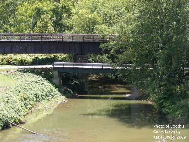
The Brook/Creek
Brook is often interchangeable with creek but, again, in the mountains we have to be a little more specific sometimes. Brooks and creeks are just small streams. They can be their own entity and carry water from a highland directly down to the valley below or they can feed into a run or stream. There is no exact science in determining the difference between a brook and a creek other than observing elevation and even that is hit-or-miss depending on the landscape.
However, if you had to try and take a guess and determine if you are beside a creek or a brook the first thing to do is look and listen to the water. Does it look like it is flowing with gravity? Does it sound like a cup that’s slightly overflowing in your sink, the little trickle of water falling down sort of ‘babbles’ as it runs down and hits the bottom? Then it’s a probably a brook.
Or, is the waterway rather level for the most part? Does it serpentine through the landscape, occasionally rising and falling while it twists and turns? Does it sound a little more like water pouring out of a hose than a container overflowing? Then it’s probably a creek which is typically found on slightly lower elevations and it’s flow has less to do with gravity and more to do with water pressure.
The Crick
Last but not least we have the crick. Now, cricks aren’t always there in the form of water but their path is still a permanent gouge in the landscape. More often than not, cricks only really flow after heavy rains.
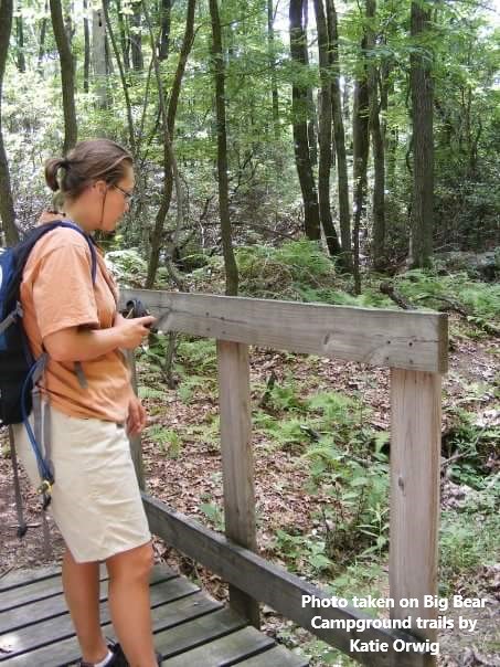
My friend, Becky, evaluating the crick below. If you look closely, you can see there is some water in there but the gap that remains in the land is the real reason for the footbridge